What Does Water Monitoring Tell Us About the Pit?
Water monitoring is a crucial element of the Berkeley Pit remedy and includes tracking of water levels and water quality in the Berkeley Pit and surrounding surface water and groundwater systems.
In addition to observations at the Berkeley Pit, measurements are taken from a system of 74 compliance points to understand the water levels in the alluvial and bedrock aquifers. These locations include points within the active mining area, adjacent to historical mining activities, and include both traditional wells and the historical mine shafts on the Butte Hill.
The water monitoring program collects information about the groundwater and its water quality. The water levels and characteristics of the contaminated groundwater help calculate the rate of rise, determine the plan for water treatment, and understand what steps are necessary to keep the water level in the pit below the protective water level.
Water Level Monitoring
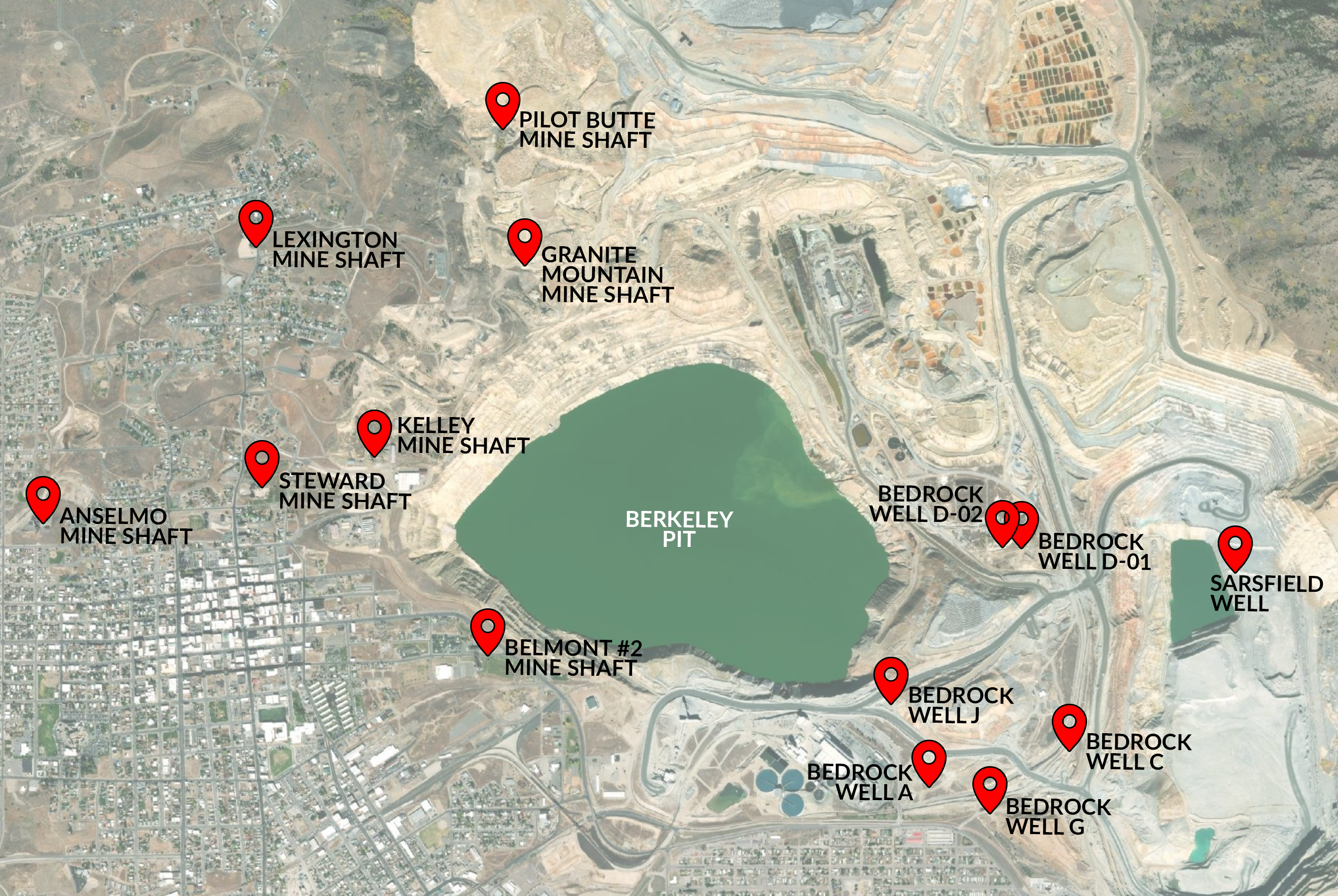
This water level monitoring program is essential to understanding the groundwater system around the Pit. Electronic devices called pressure transducers have been installed at 14 compliance points throughout the bedrock system to continuously record water levels in wells and mine shafts. These compliance points include the historic Anselmo, Steward, Pilot of Butte, Granite Mountain, Lexington, and Kelley Mine shafts, the Continental Pit, Belmont Well No. 2, and bedrock wells A, C, D-1, 2, G, and J.

Compliance points around the Berkeley Pit.
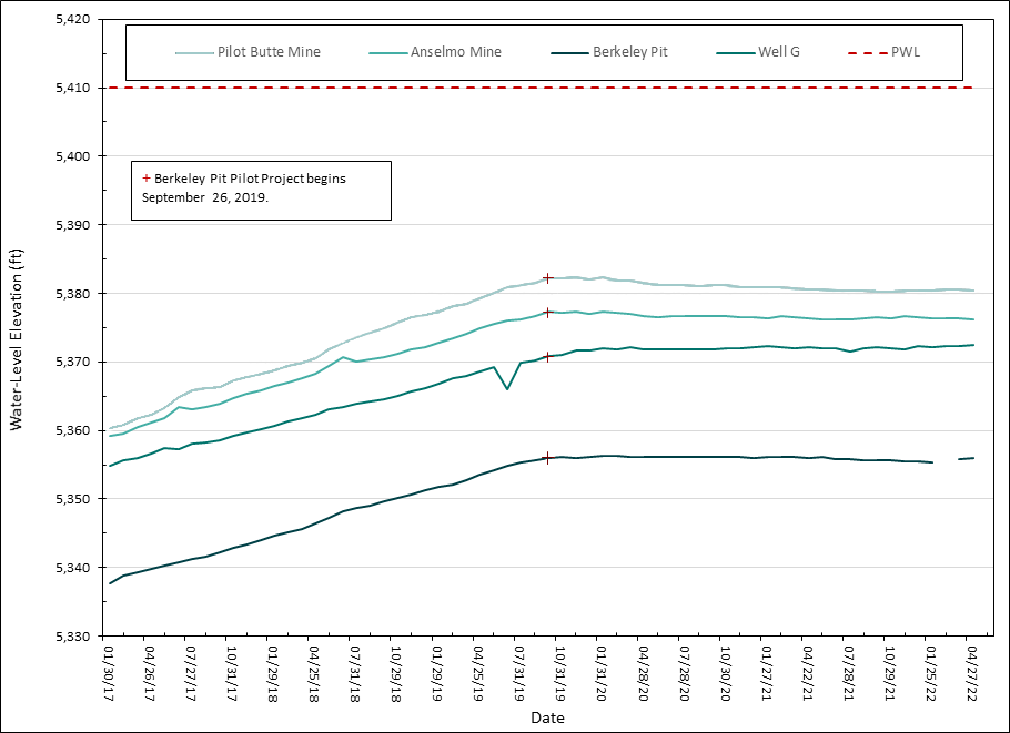
The Pilot Butte mine shaft currently has the highest water elevation amongst these compliance points and the Berkeley Pit’s water level is approximately 25 feet lower than the water level in the Pilot of Butte mine shaft.
Data from the pressure transducers is downloaded monthly by the Montana Bureau of Mines and Geology (MBMG). MBMG analyzes the data and prepares monthly reports detailing the water levels and other findings of the monitoring activities.
Graph showing the change in water level from January 2017 to March 2020 at various compliance points.
Water Quality Monitoring
Water quality data measures the content of various metals and minerals in the Berkeley Pit water. These and other heavy metals are the focus of the water quality monitoring program to understand the potential hazards the Berkeley Pit may pose to human health and the environment. In addition to metals concentrations, temperature, pH, dissolved oxygen, alkalinity, acidity, and hardness are also monitored. This information is used to understand change over time.
For many years, water samples were collected from the Berkeley Pit surface by people in boats or standing on the ice when the Pit was frozen. Due to safety concerns, people have not been allowed on the water since 2013. Surface samples could be collected from the shore, but the approach prevents samples from various depths below the surface.
To address this limitation, Montana Bureau of Mines and Geology worked with engineers at Montana Tech to develop a drone boat that is remotely operated from the shore. The drone boat has pumps and tubing that allows for the collection of samples from multiple depths and locations within the Berkeley Pit while keeping the drone operators safe on the shore.
Water Monitoring Reports
Montana Bureau of Mines and Geology prepares monthly and annual reports that present the water elevation and chemistry data collected for the Butte Mine Flooding Operable Unit.
The annual reports and other Berkeley Pit publications can be found and downloaded from the Montana Bureau of Mines and Geology publications website by searching for the keyword “Butte”.
If you cannot find a document you’re looking for, please email us at info@pitwatch.org.

