")
Maps from the Montana Bureau of Mines & Geology (MBMG) showing Berkeley Pit-related alluvial and bedrock monitoring sites have been added to PitWatch.Org. View snapshots of the maps below, click on an image to view a larger version, or use the links at the bottom of the page to download printable .pdf versions of the maps.
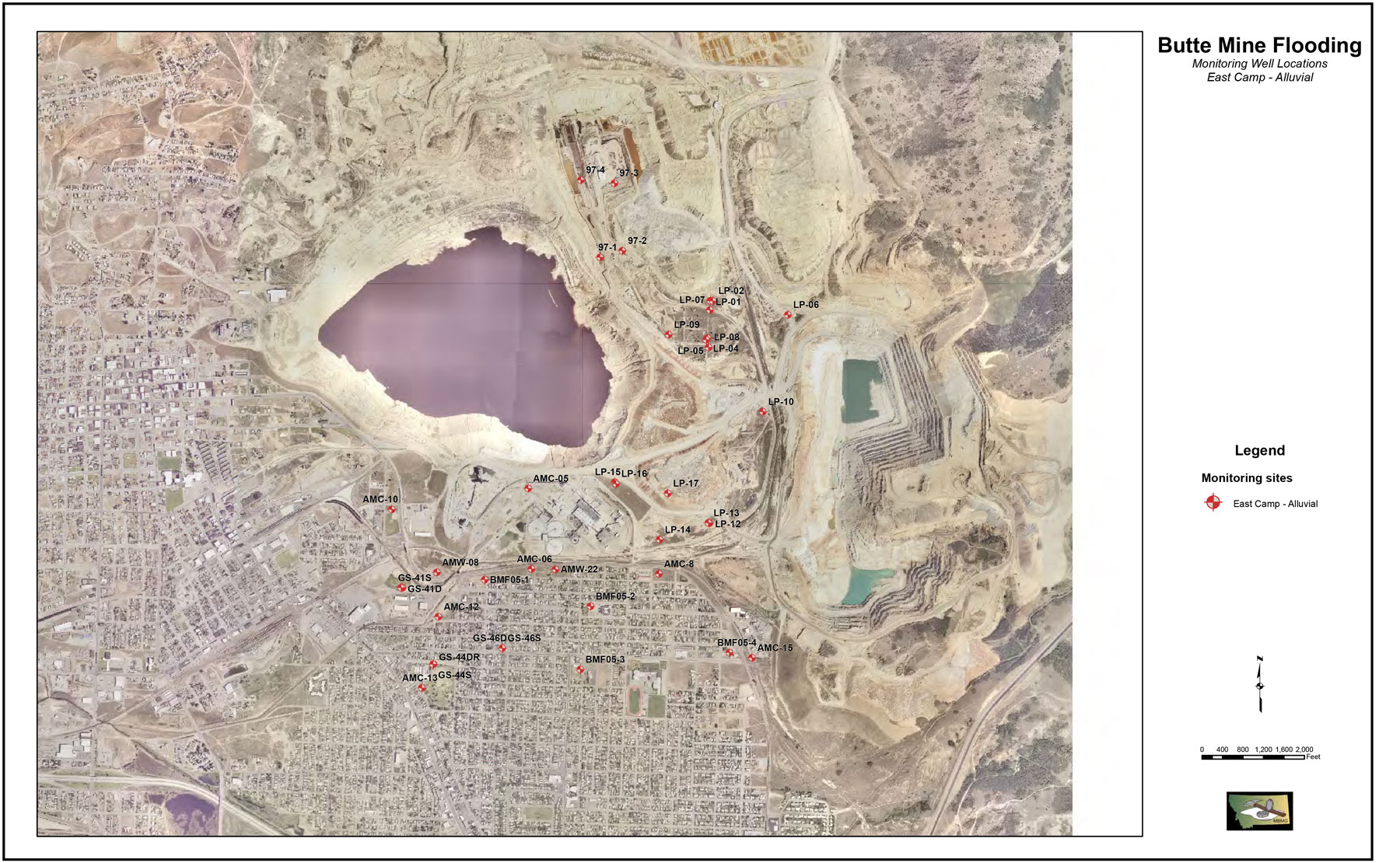
This map shows the locations of groundwater monitoring points for the alluvial aquifer in the East Camp area of the Butte Mine Flooding Operable Unit of the greater Butte Superfund site.
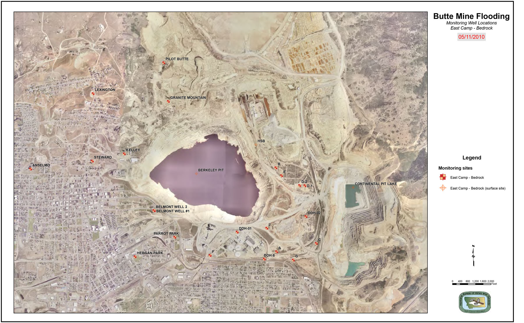
This map shows the locations of groundwater monitoring points for the bedrock aquifer in the East Camp area of the Butte Mine Flooding Operable Unit of the greater Butte Superfund site.
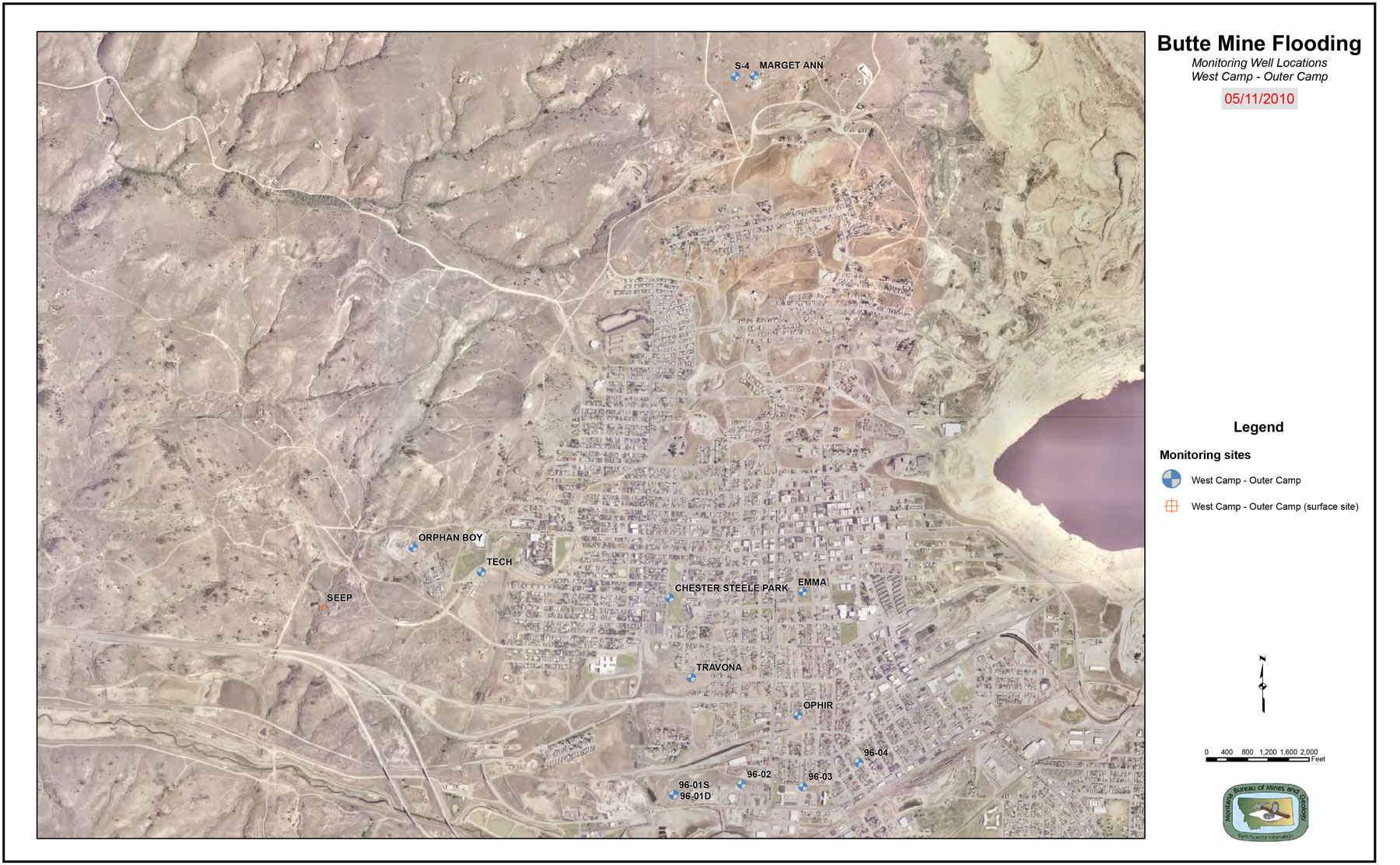
This map shows the locations of groundwater monitoring points for the West and Outer Camp areas of the Butte Mine Flooding Operable Unit of the greater Butte Superfund site.
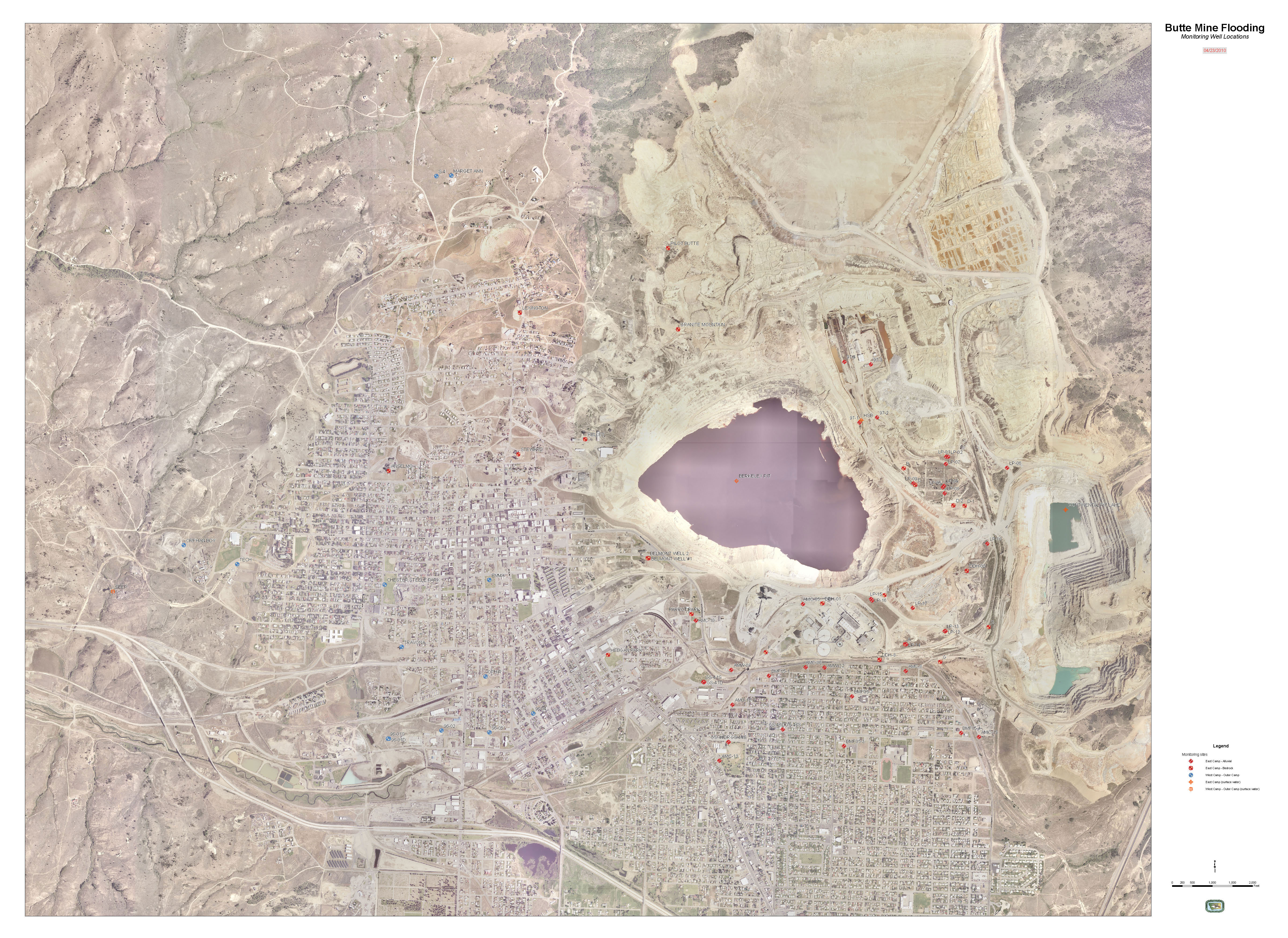
This map shows the locations of all groundwater monitoring points for the Butte Mine Flooding Operable Unit of the greater Butte Superfund site.